subLogic's Scenery Disk 7: Areas of Interest
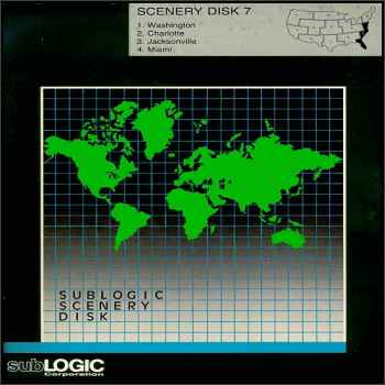
In 1988 subLogic released "Scenery Disk 7" (SD-7) for Microsoft Flight Simulator. This scenery disk contained some of the most detailed scenery for the simulator at the time, and marked the transition into an entire new era of scenery disks. Scenery Disk 7 was released following subLogic's previous six scenery disks, and incorporated brand new features not seen in the previous six.
"Scenery Disk 7" covered the entire southeastern coast of the United States, including portions of Pennsylvania, Delaware, New Jersey, Maryland, Virginia, North Carolina, South Carolina, Georgia, Florida (including the Florida Keys), and the islands of the Bahamas. Special attention to detail was given to the areas of Washington D.C., as well as Cape Canaveral and Miami on the east coast of Florida.
Anyhow, the files included in this archive (SD-7Area.zip) are basically an historical tribute to subLogic's Scenery Disk 7 from yesteryear. subLogic's scenery disk can be still used today with Lago's "Airline Simulator" and NomisSoft's "Airline Simulator 2", Microsoft's "Flight Simulator" versions 2.0 to 95, as well as subLOGIC's "Flight Assignment: Airline Transport Pilot", "Jet", "Thunder Chopper", and their unusual simulator "UFO".
Included in this archive are the files "SD-7AREA.SMS" and "SD-7AREA.IN". These files are for use with subLogic's "Scenery Management System" (the successor to their "New Facilities Locator") that shipped with Lago's "Airline Simulator" and NomisSoft's "Airline Simulator 2", as well as subLOGIC's "Flight Assignment: Airline Transport Pilot", and their "USA East" and "USA West" scenery disk packs.
If you have the Scenery Management System installed on your hard drive, copy these files to your simulator's "\SMS" subdirectory. If you have the New Facilities Locator installed, first rename the file "SD-7AREA.SMS" to the new filename "SD-7AREA.NFL", and then copy it to your simulator's "\NFL" subdirectory.
The "SD-7AREA.IN" file (which has been renamed to "SD-7AREA.IN" from the original filename "MINE.IN") is the file that the New Facilities Locator and the Scenery Management System generates when you select "Define your own location" from the NFL/SMS menu from within your simulator. Usually you would then run the utility "GENMINE.EXE" which would read the file "MINE.IN" and generate the "MINE.NFL" or "MINE.SMS" databases. It is included in this archive so that you can add more locations to it, or edit the existing ones.
Listed below are the various preset locations included in the "SD-7AREA.SMS" database file, as well as general notes and screenshots of the locations: Note that I'm a bit partial towards the South Florida and Bahamas regions of Scenery Disk 7, as I lived in Dade County from 1975 to 2005 about a mile from Tamiami Executive Airport, and have flown numerous (many more than I can count or remember <G>) round-trip PC flights departing from KTMB ILS runway 9 with my trusty Cessna Skylane 182 :)
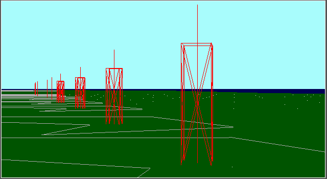
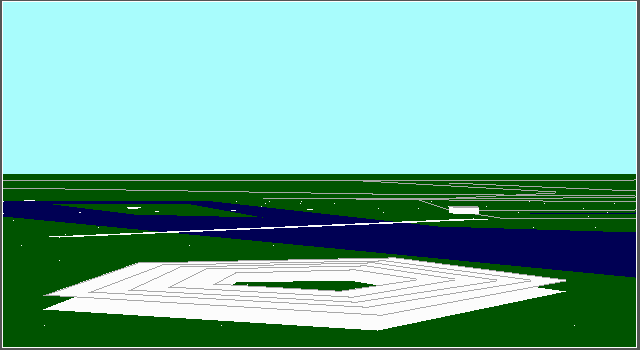
"Atlas Rocket Launch Gantries"
Complex 36 at Cape Canaveral, Florida, where the nine old Mercury mission Atlas rocket launch gantries are located.
Altitude: 0 AGL / Heading: 360ē
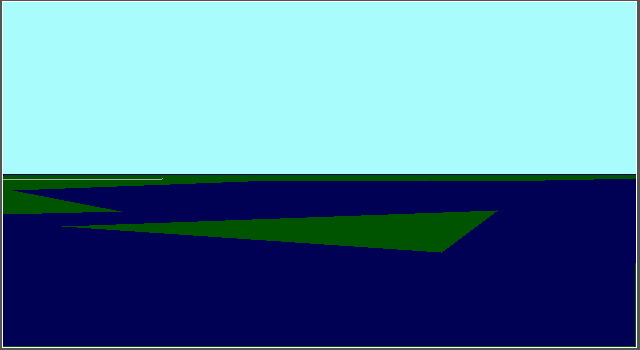
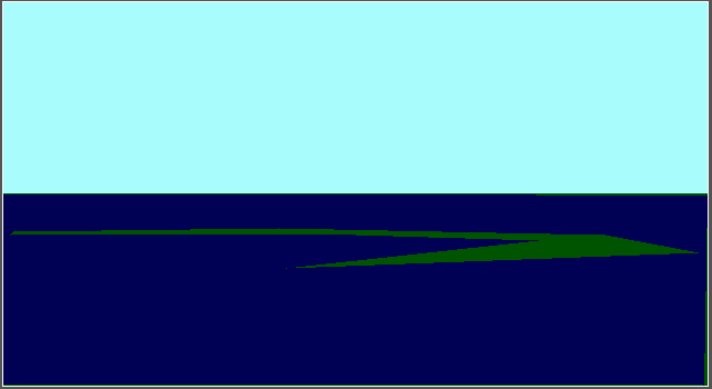
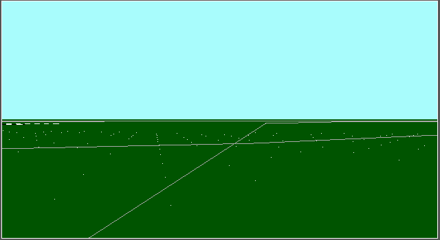
"Cedar Key"
Cedar Key in Levi County, Florida. Not much to see here, but the outline of the island (sort of <G>) exists within the scenery.
Altitude: 0 AGL / Heading: 360ē
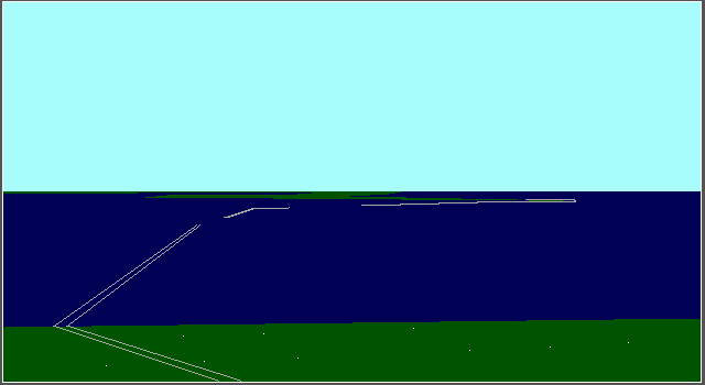
"Chesapeake Bay Bridge Tunnel"
The Chesapeake Bay Bridge Tunnel (an engineering marvel) in the Tidewater area of Virginia.
Altitude: 0 AGL / Heading: 360ē
"Crystal River at US 19"
US Highway 19 in Crystal River, Florida.
Altitude: 0 AGL / Heading: 360ē
"Dry Tortugas"
The Dry Tortugas National Park (where the historical Fort Jefferson is located), south of Key West, Florida. Again, not much to see here, but the outline of the island exists within the scenery.
Altitude: 0 AGL / Heading: 360ē
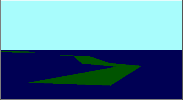
"Elliot Key"
Elliot Key in Biscayne Bay, Florida. Again, not much to see here, but the outline of the island exists within the scenery.
Altitude: 0 AGL / Heading: 360ē
"Fayetteville Motor Speedway"
Fayetteville Motor Speedway, a .4 mile dirt oval race track in Fayetteville, North Carolina.
Altitude: 0 AGL / Heading: 360ē
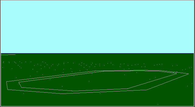
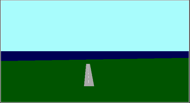
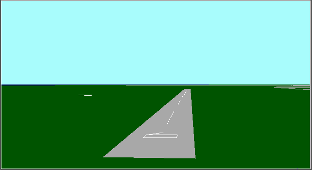
"KEYW Key West Intl. Airport"
KEYW Key West International Airport runway 27, in the Florida keys.
Altitude: 0 AGL / Heading: 270ē
"Khrome Avenue & Tamiami Trail"
Khrome Avenue and Tamiami Trail (US Highway 41) intersection in Dade County, Florida.
Altitude: 0 AGL / Heading: 360ē
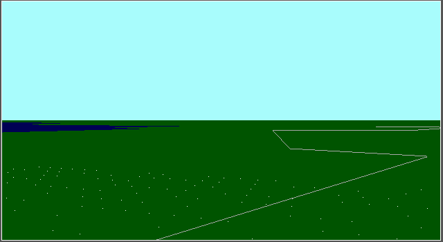
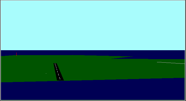
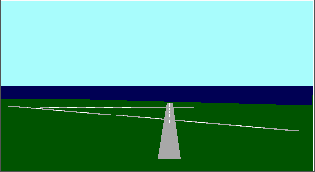
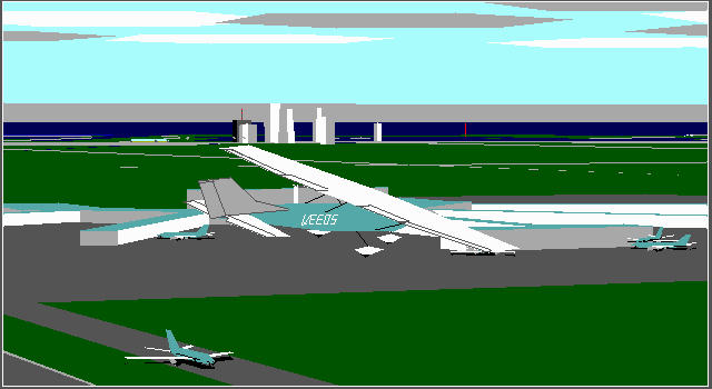
"KTMB Tamiami Executive Airport"
KTMB Tamiami Executive Airport ILS runway 9R in Kendall, Florida.
Altitude: 0 AGL / Heading: 090ē
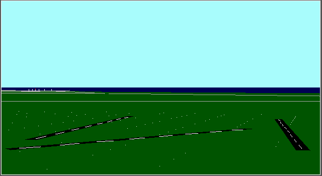
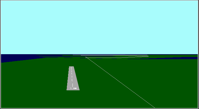
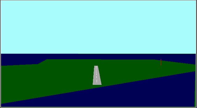
"KXMR Cape Canaveral Skid Strip"
KXMR Cape Canaveral Skid Airstrip runway 13 at Cape Canaveral, Florida. The Skid Airstrip was used in testing the first military cruise missiles, which were remotely controlled to a landing on the strip. Because they had no landing gear, they were just "skidded" on their bellies to a complete stop. Note that in the scenery the runway numbers are backwards <G>!
Altitude: 0 AGL / Heading: 130ē
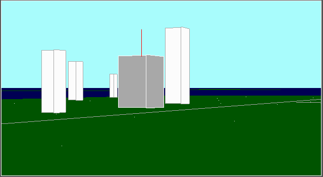
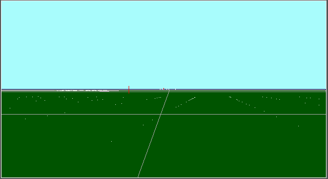
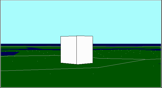
"Miami Herald Building"
The Miami Herald newspaper building in Miami, Florida.
Altitude: 0 AGL / Heading: 136ē
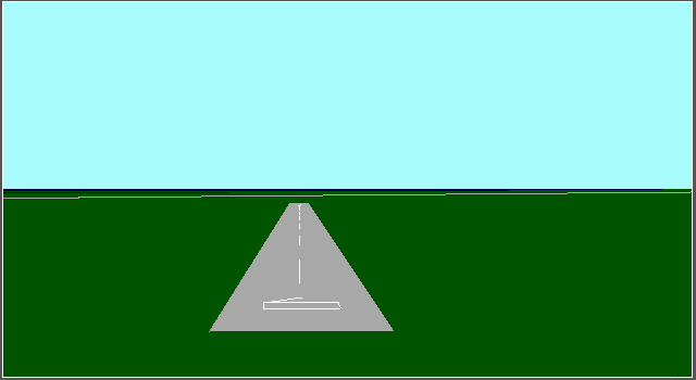
"MYAK Congo Town Airport"
MYAK Congo Town Airport runway 10 at Andros Island, Bahamas.
Altitude: 0 AGL / Heading: 100ē
"MYAM Marsh Harbour Airport"
MYAM Marsh Harbour Airport runway 9 at Abaco Island, Bahamas.
Altitude: 0 AGL / Heading: 090ē
"MYAT Treasure Cay Airport"
MYAT Treasure Cay Airport runway 13 at Abaco Island, Bahamas.
Altitude: 0 AGL / Heading: 130ē
"MYBS South Bimini Airport"
MYBS South Bimini Airport runway 9 at Bimini Island, Bahamas.
Altitude: 0 AGL / Heading: 090ē
"MYGF Freeport Intl. Airport"
MYGF Freeport International Airport runway 6 in Freeport, Bahamas.
Altitude: 0 AGL / Heading: 060ē
"MYGM Grand Bahama Aux Airfield"
MYGM Grand Bahama Auxiliary Airfield runway 6 at Grand Bahama Island, Bahamas.
Altitude: 0 AGL / Heading: 060ē
"MYNN Nassau Intl. Airport"
MYNN Nassau International Airport runway 31 in Nassau, Bahamas.
Altitude: 0 AGL / Heading: 310ē
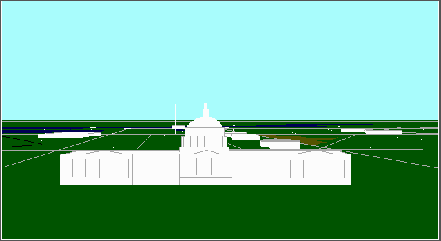
"Pentagon"
The Pentagon building in Washington, D.C.
Altitude: 0 AGL / Heading: 360ē
"Shuttle Assembly Building"
The space shuttle vehicle assembly building at Cape Canaveral, Florida. This huge building is where the booster rockets are fitted to the space shuttle and main fuel tank before being rolled out to the launch pad.
Altitude: 0 AGL / Heading: 360ē
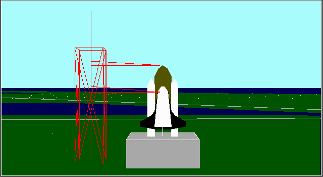
"Space Shuttle Launch Pad"
The space shuttle awaiting liftoff on launch pad 39A at Cape Canaveral, Florida.
Altitude: 0 AGL / Heading: 360ē
"US 1 and Florida Turnpike"
US Highway 1 and the Florida Turnpike intersection in Homestead, Florida.
Altitude: 0 AGL / Heading: 360ē
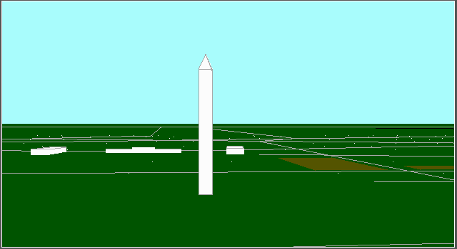
"Washington Monument"
The Washington Monument in Washington, D.C.
Altitude: 0 AGL / Heading: 360ē
"White House"
The White House in Washington, D.C.
Altitude: 0 AGL / Heading: 280ē
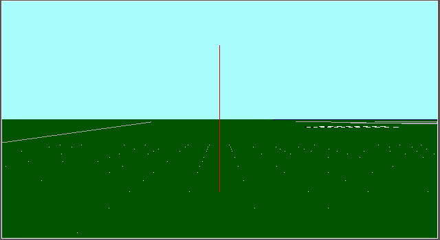
"WTVJ Channel 6 Antenna"
The WTVJ channel 6 antenna in Homestead, Florida.
Altitude: 0 AGL / Heading: 360ē
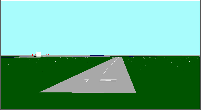
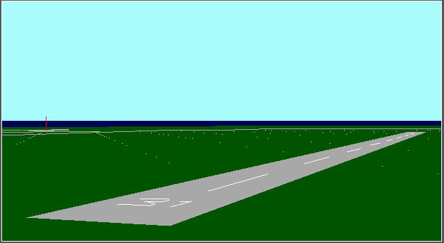
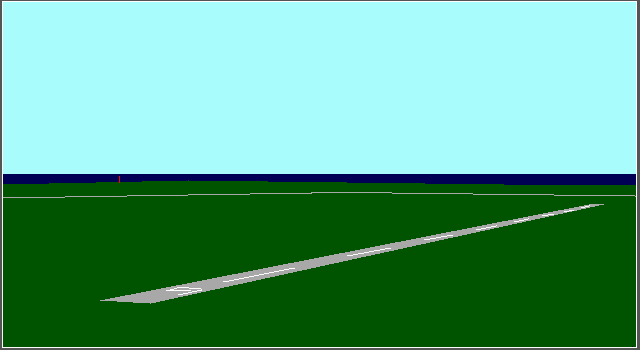
"X68 Shuttle Landing Facility"
X68 Shuttle Landing Facility runway 15 at Cape Canaveral, Florida. The runway at X68 is 350 feet wide and 17,000 feet long, and one of the largest runways in the world!
Altitude: 0 AGL / Heading: 150ē
In conclusion, I hope that these files and screenshots bring back fond memories of flight simulation from yesteryear... they sure do for me :)
ENJOY!